Deceptively hilly hike at Calero County Park

This afternoon we took what we thought would be a less intense pleasant stroll at Calero County Park, after our long hike at Big Basin at the weekend.

2016.01.11 Endomondo Data

It wasn’t.

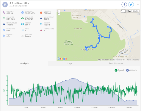
It’s not entirely evident by the data, but the trail ends up as a very up and down, up and down, then up and up and up. It is deceptive, because the inclines are hidden behind corners or over ridges, and you just suddenly realize you have to go up some more!

You can download the park map here.

We were going to follow the hike as described on BAhiker here, but cut it a bit shorter as it was quite sunny and warm, so on such exposed trails we got a bit toasty, and also because we were feeling tired….. I never claimed that I didn’t get lazy!

Parking by the main entrance, we took the Access Trail > right on Los Cerritos Trail > right on Los Cerritos Trail > left on Peña Trail > left on Peña Trail > right on Los Cerritos Trail > left on Access Trail

Calero Reservoir

The reservoir at first glance didn’t look too bad, but then as we looked closer, the water should up to that upper line! It has just been empty/low for so long that the plants and grasses have taken over!

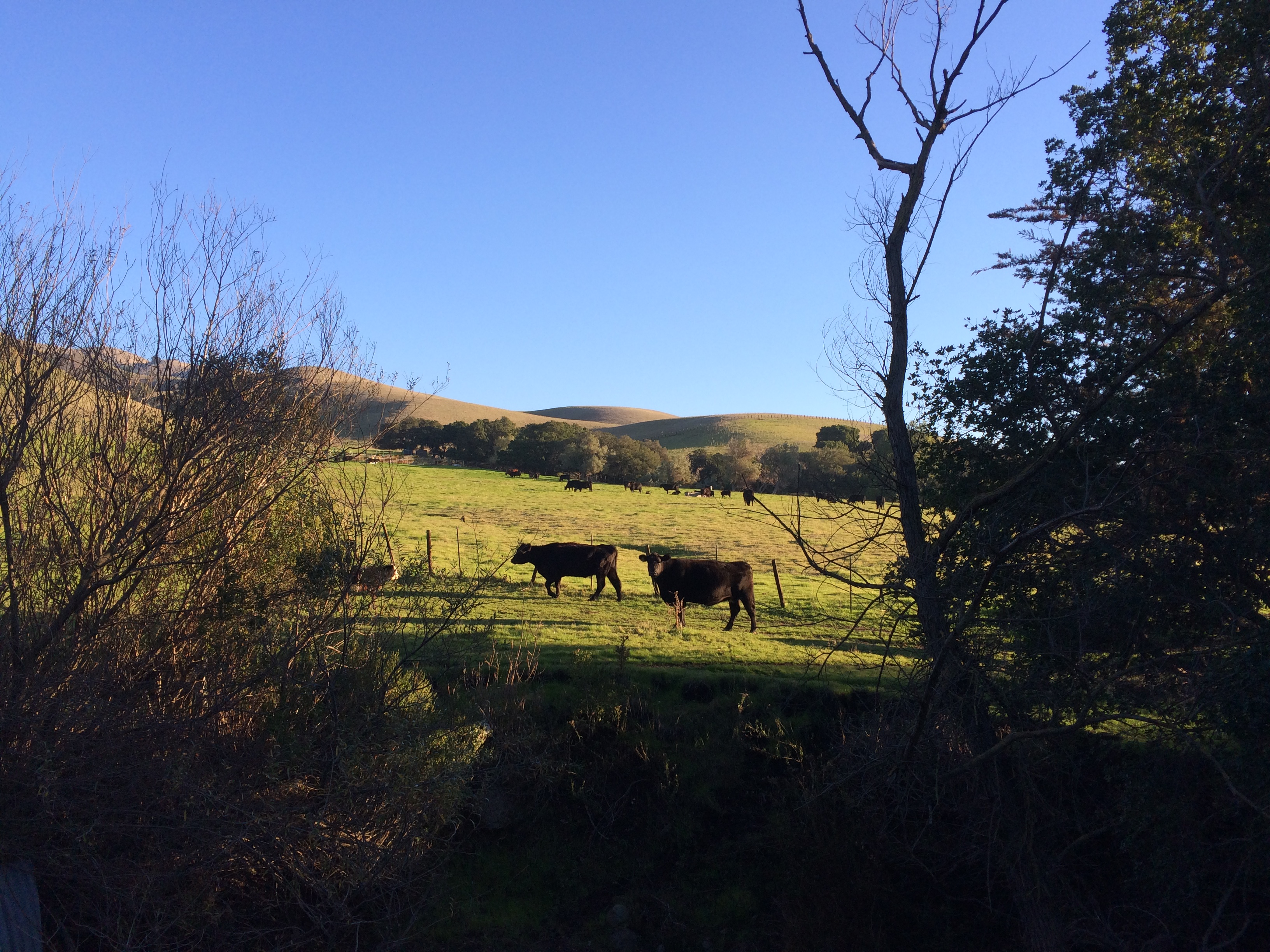
Just a short hike due to not having a lot of time, but quite pleasant even if it was deceptively hilly!

p.s. I have a fitbit, as do a few of my friends, and today one of them challenged me to a goal day – where you need to meet your step goal (mine is set to 10,000). I met mine at 197%! #nailedit

Winter Waterfalls at Big Basin Redwoods State Park

These past few weeks in the Bay area we have been having fairly heavy rain.

Yes! Rain!

For the previous two years we have lived here there was barely any, and so to take full advantage of the benefits of such precipitation, we took a long hike at Big Basin Redwoods State Park.

IMG_2997

Among other inducements, such as the beautiful Redwoods, the park features winter waterfalls.

Berry Creek Falls
Berry Creek Falls

You can download the full brochure here.

This was a hike to see Berry Creek Falls, Golden Falls, Cascades, and SIlver Falls, but taken in the opposite direction to that given on the BBRSP website.

2016.01.09 Endomondo Data

Use Skyline to the Sea Trail from the parking lot > left on Dool Trail > left on Sunset Trail > stay on Sunset Trail > go right to stay on Sunset Trail > left on Berry Creek Falls Trail > left on Skyline to the Sea Trail > stay on Skyline to the Sea Trail > follow Skyline to the Sea Trail back to park headquarters.

Although the hike (in the opposite direction as posted on the website) is described as strenuous, the main challenge is probably due to the length, rather than any steep grade.

Cascades
Cascades

There are some more challenging aspects – narrow trails, slippery rocks by the falls…. Oh and a lot of fallen trees.

Silver Falls
Silver Falls

But overall it wasn’t too tough at all, and the views of the falls and trees more than make up for it.

Golden Falls
Golden Falls

Today was also International Homemade Hobnob Day. Yep. It’s a thing. So we took some to the park with us….

Hobnobs on the trail.

Hobnobs all round!

#hikingmondays

For the next 6 weeks or so I have Mondays off, which is of course quite splendid.

What to do with this time? Grab a friend and get out hiking! As this friend is a fellow Brit, I couldn’t resist taking her to English Camp.

This was just a little short hike at Almaden Quicksilver County Park.

Currently there is a trail closure of Randol Trail, which makes planning a route a little more tricky – it either ends up just as a short one, or a bit longer than anticipated!

2015.01.04 Endomondo Data

You can find the full trail map here.

Starting at the Mockingbird Hill Lane Entrance, take the New Almaden Trail > left on Hacienda Trail > right on Capehorn Pass Trail > straight on Mine Hill Trail > straight on Mine Hill Trail > left on Castillero Trail > English Camp > left, back to Mine Hill Trail > continue on Mine Hill Trail back to Capehorn Pass Trail > right on Hacienda Trail > left on Virl O. Norton Trail > Mockingbird Hill Lane Entrance.

We saw one on these tiny little lizard things that I see quite often there:

Little lizard

We hope to go a little further next week!

A Short Steep Hike to the top of Mission Peak

Happy New Year!

I took advantage of a bonus day off to hike to the top of Mission Peak. We had previously done a long hike from Ed R. Levin County Park to the top of Monument Peak, but this a shorter – but very steep! – hike to the top of Mission Peak. This hike is described in it’s entirety on the Bay Area Hiker website here.

2015.12.31 Endomondo Data

Yup, just over 2000ft elevation gain over 3 miles, then back down again. You can find a trail map here.

The view is pretty wonderful.

Mission Peak Panorama

…and we got to see the Christmas tree:

#xmasonthepeak

We took some Christmas dinner leftovers with us – have pie, will hike.

Pie on Mission Peak

The weather was pretty great for it, nice and cool, but sunny and clear. The main trail was in good condition, but Horse Heaven was a little muddy….

Muddy Horse Heaven

…and we manage to escape being maimed by the cows.

Cows @ Horse Heaven

Very important.