All posts by Lindsay

A Science Nerd/ Crafter/ Baker. Into Bacteria and bobbins.

A pleasant surprise at Big Basin Redwoods State Park

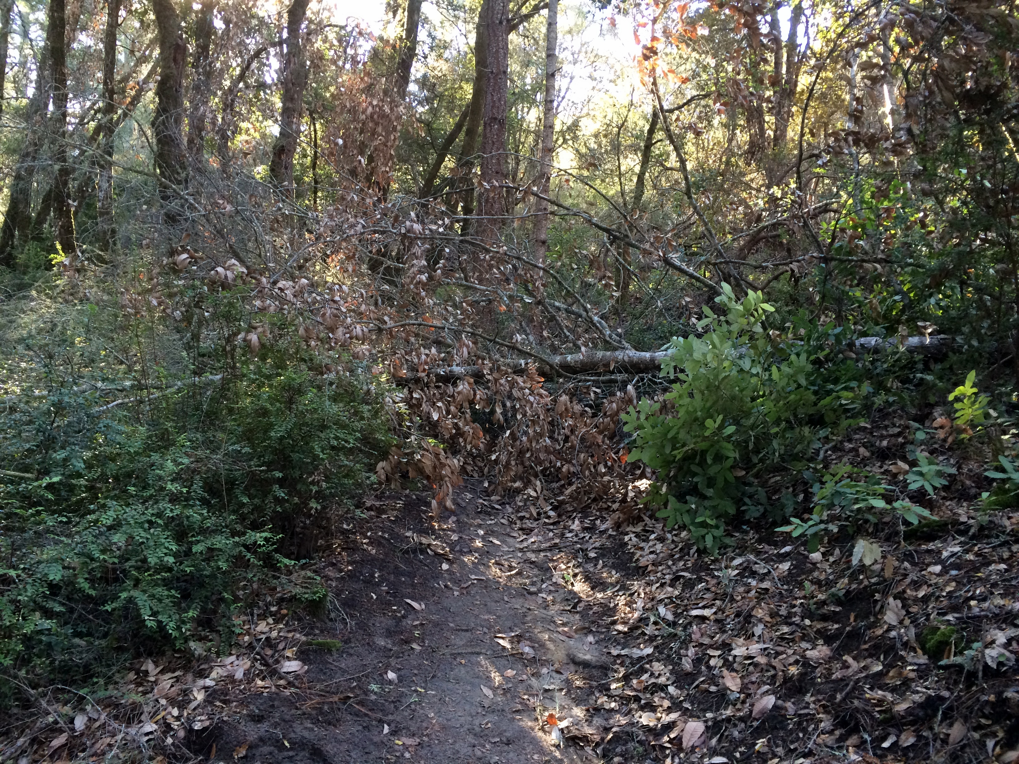
It is summer, and with summer comes either hiking early or hiking shady in order to avoid the heat. A whole host of excellent choices for the latter exist in the Santa Cruz mountains, full of redwoods with a nice dose of hilly hiking.

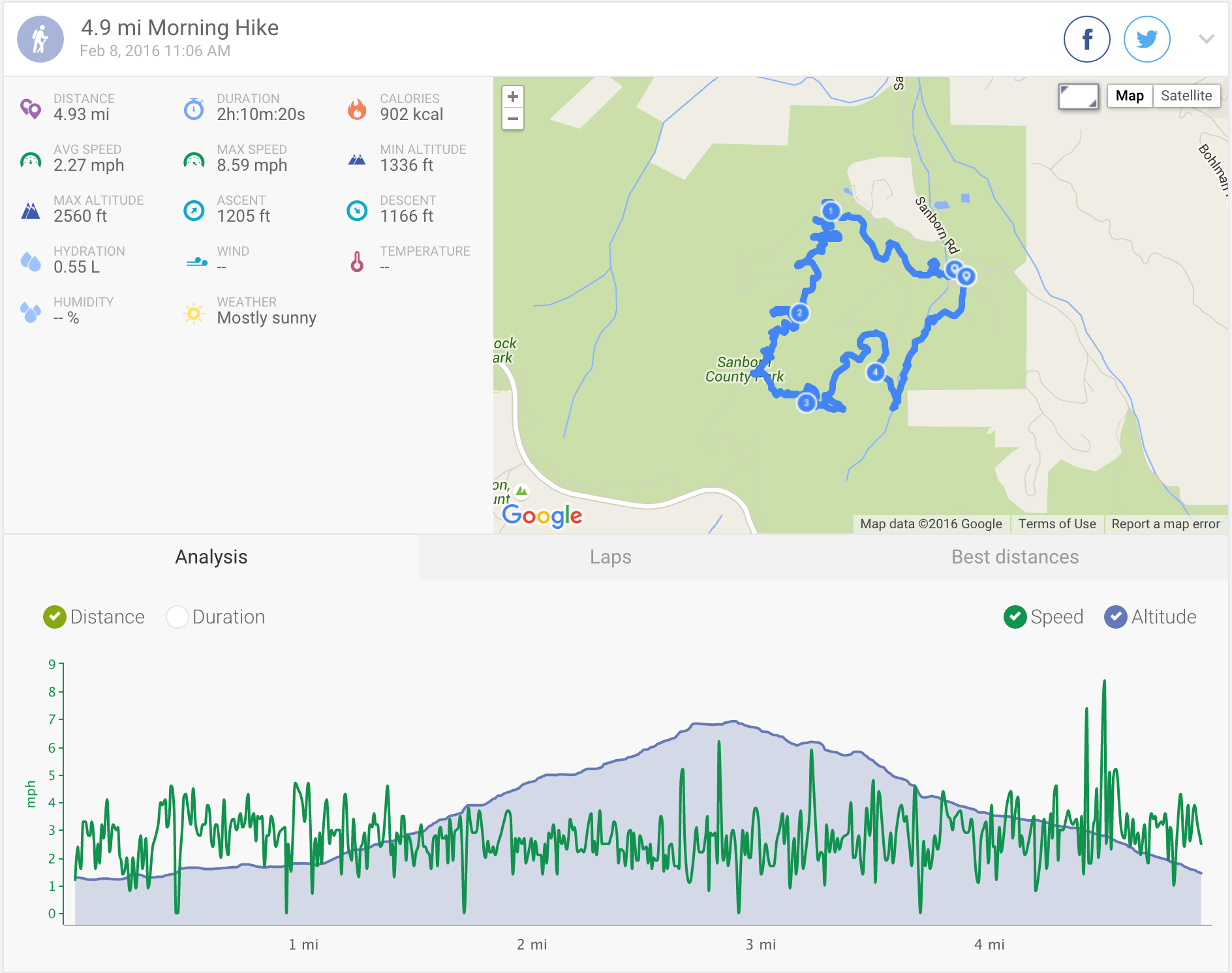
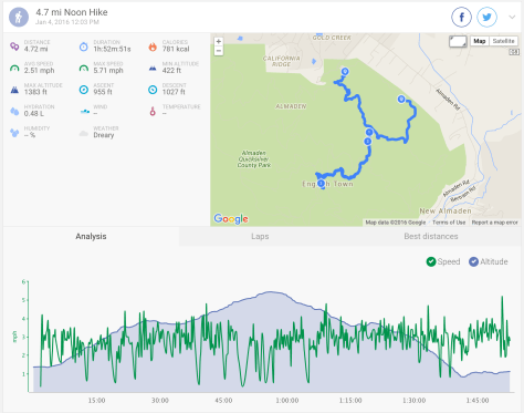
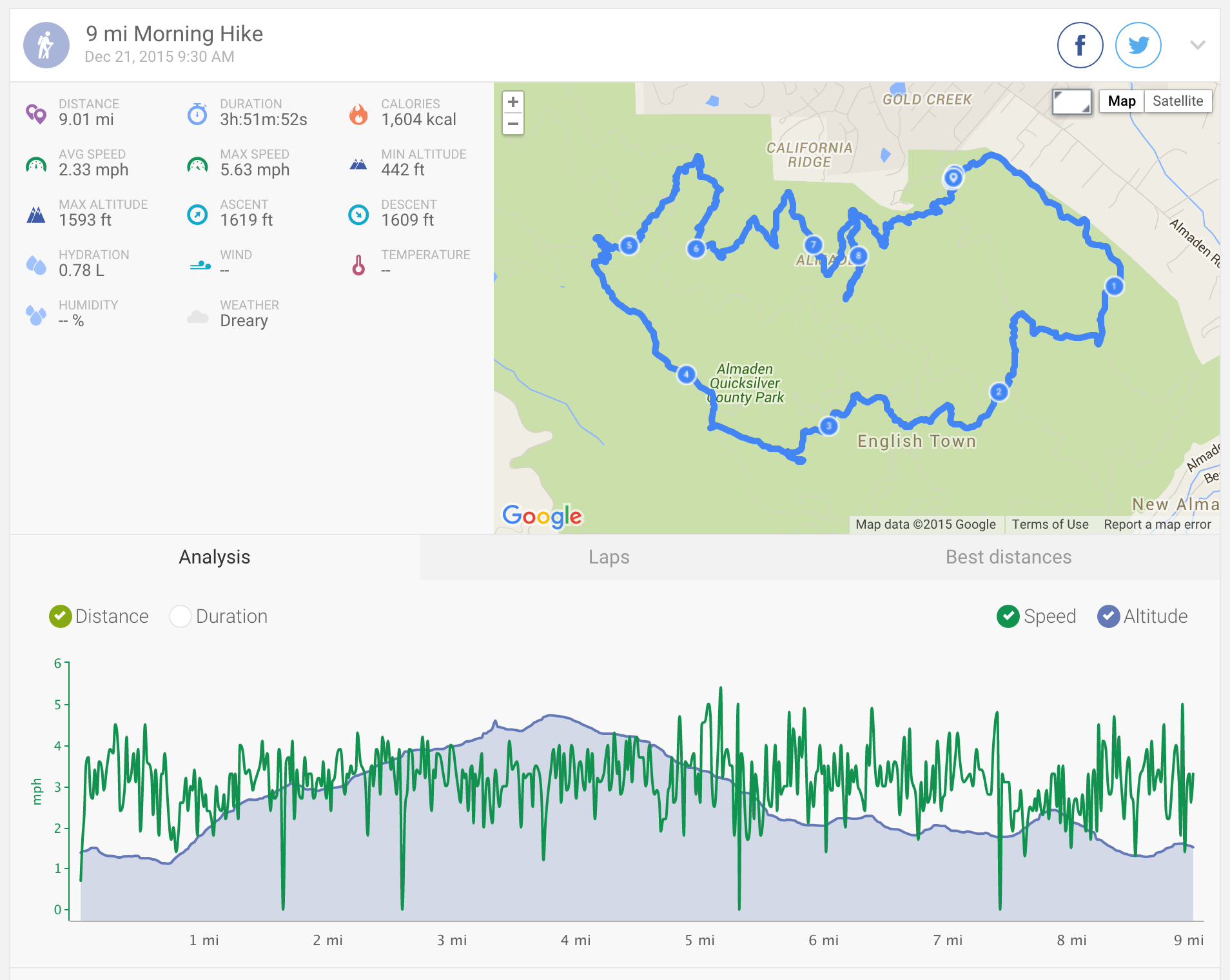
Today we went to Big Basin Redwoods State Park, a great choice for the summer due to nice shady trails (but also awesome in the winter/springtime when the rain has been falling so you can really enjoy those waterfalls!) You can find the full Map/Brochure here, but we took a short-ish route today represented below:

Big Basin Redwoods State Park Trail Map

The park was a little busier than last time, so we ended up parking in the additional parking located a little way up North Escape Road.

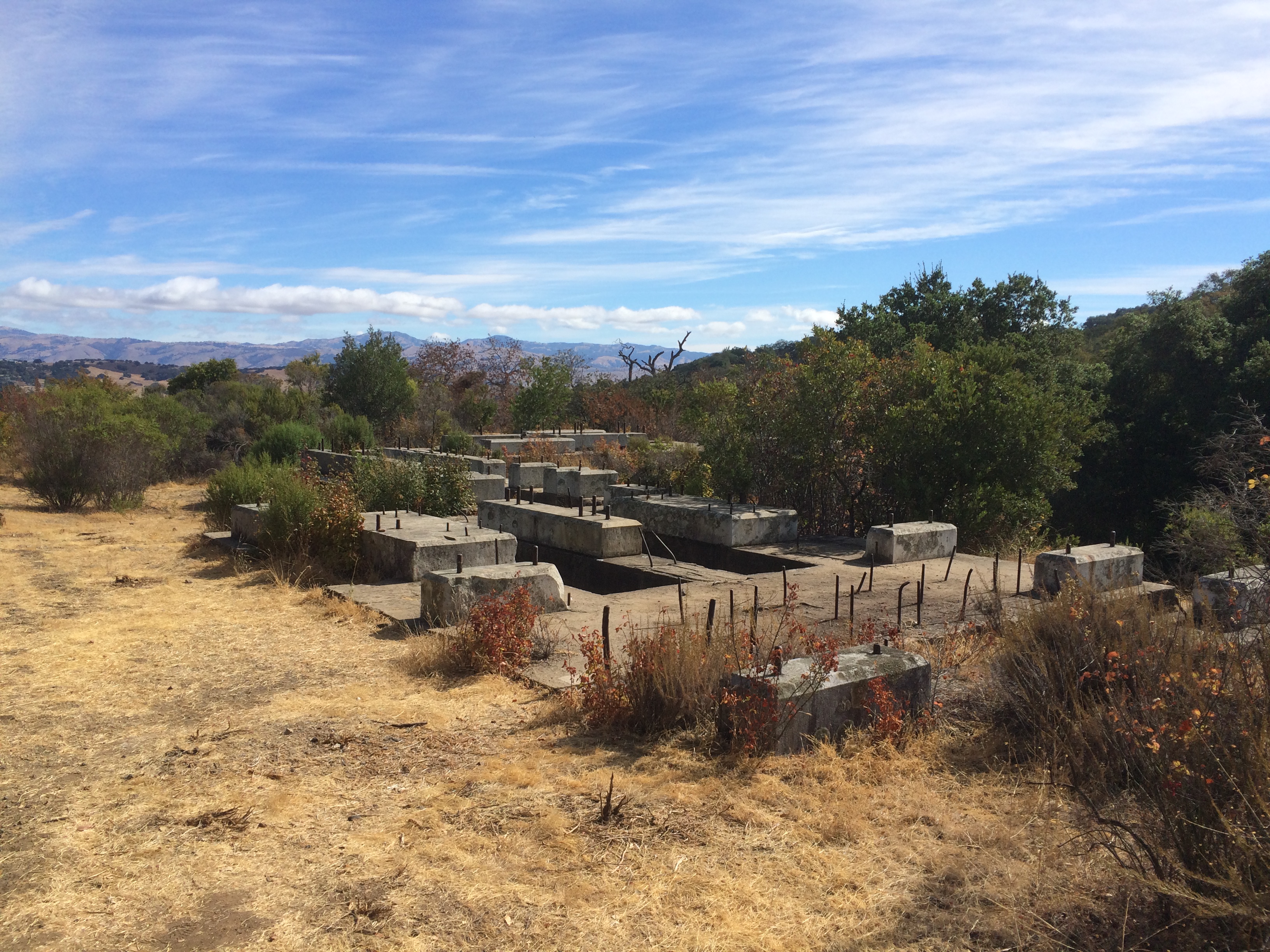
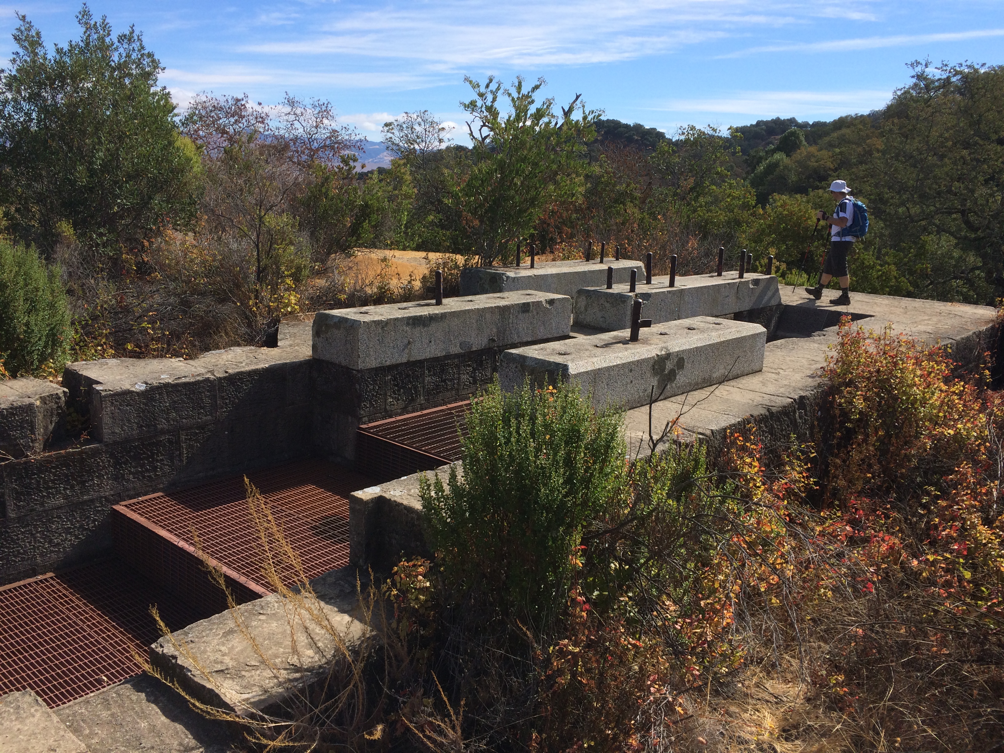
Our route today started from the North Escape Road/Gazos Creek Road bridge access on to Skyline to the Sea Trail, following this upwards past the Maddock Family Cabin Site until it meets Meteor Trail. Turn left here, following Meteor Trail until it joins Middle Ridge Road. Turn left, following it upwards until you reach a point marked as Ocean View Summit. A slight detour from the trail at this point offers a peek at the ocean through a gap in the mountains. Continue to follow Middle Ridge Road down until it meets up with Gazos Creek Road, turn left, and follow this road back to the start at the bridge over Opal Creek that takes you back to North Escape Road.

Simples! Well recommended as a nice, short, but slightly challenging hike – it definitely isn’t flat! We really enjoyed it!

2016.07.10 Endomondo Data: Big Basin Redwoods State Park

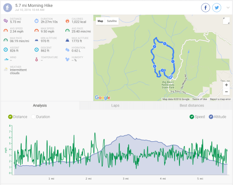
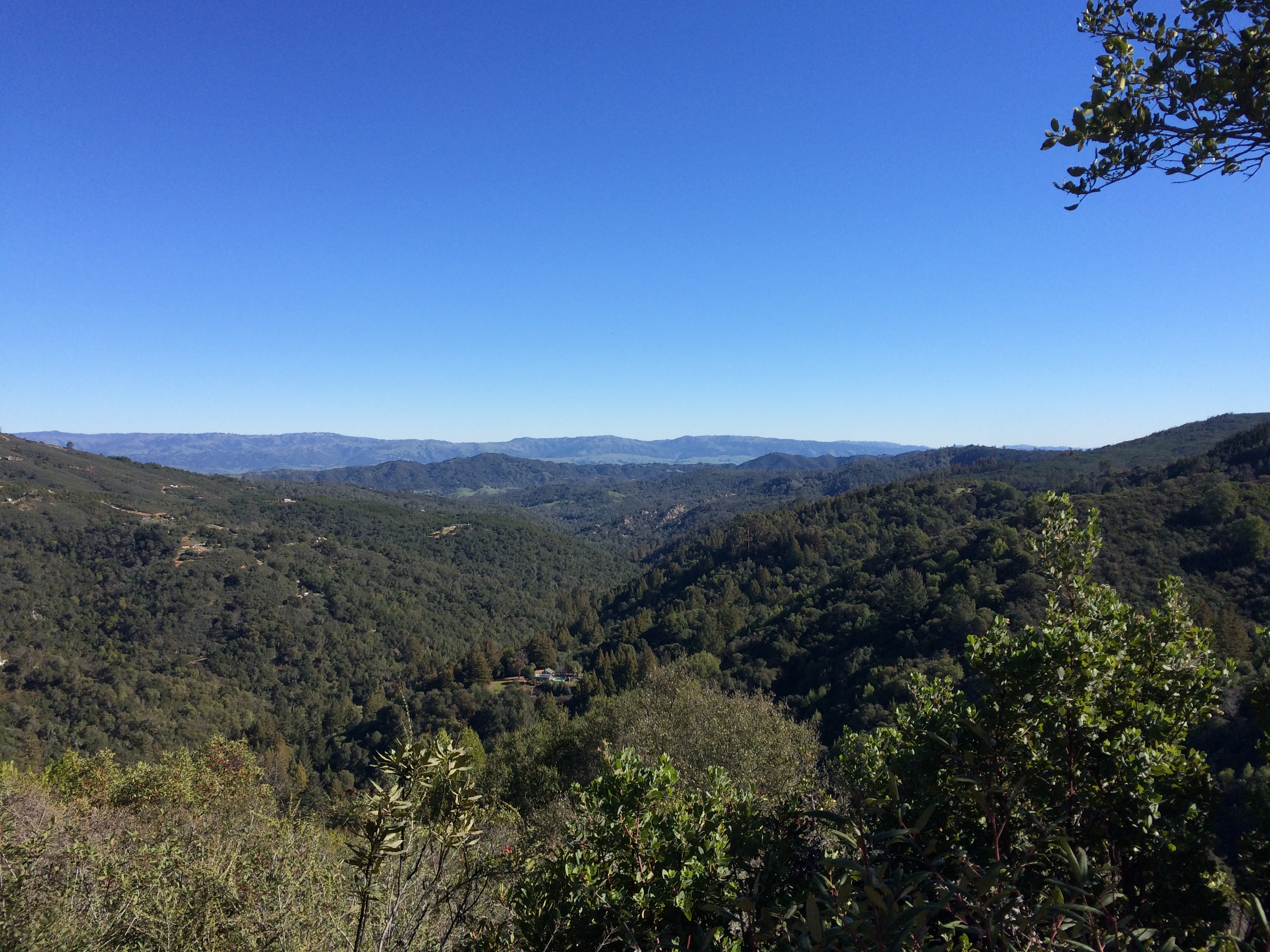
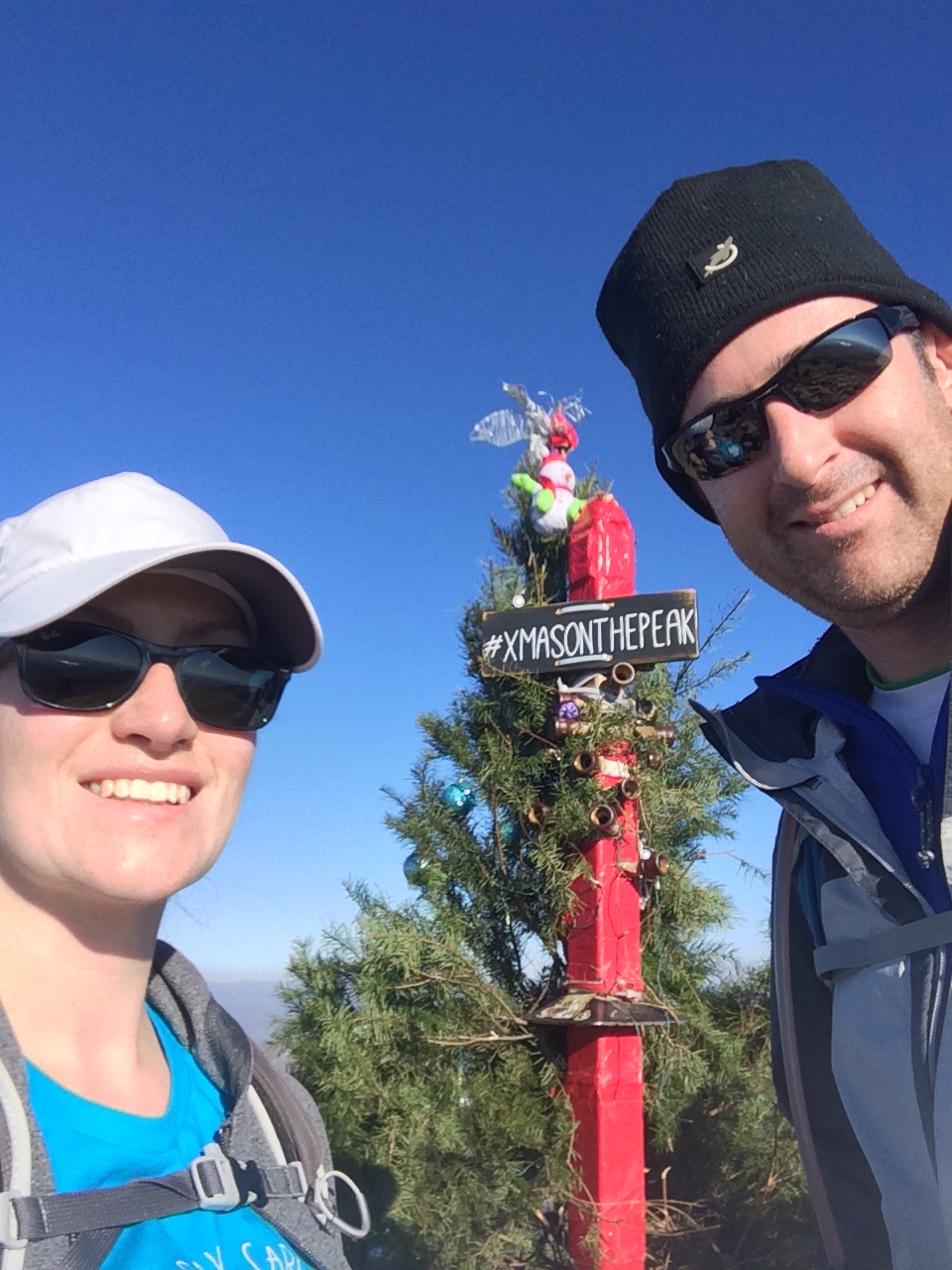
As you can see from the chart at the bottom, the route starts off nice and flat-ish, but then involves some steep segments (way to work those glutes!), and a steady downhill on nice flat roads. The uphill is totally worth it though, as you reach this sandstone ridge at the top:
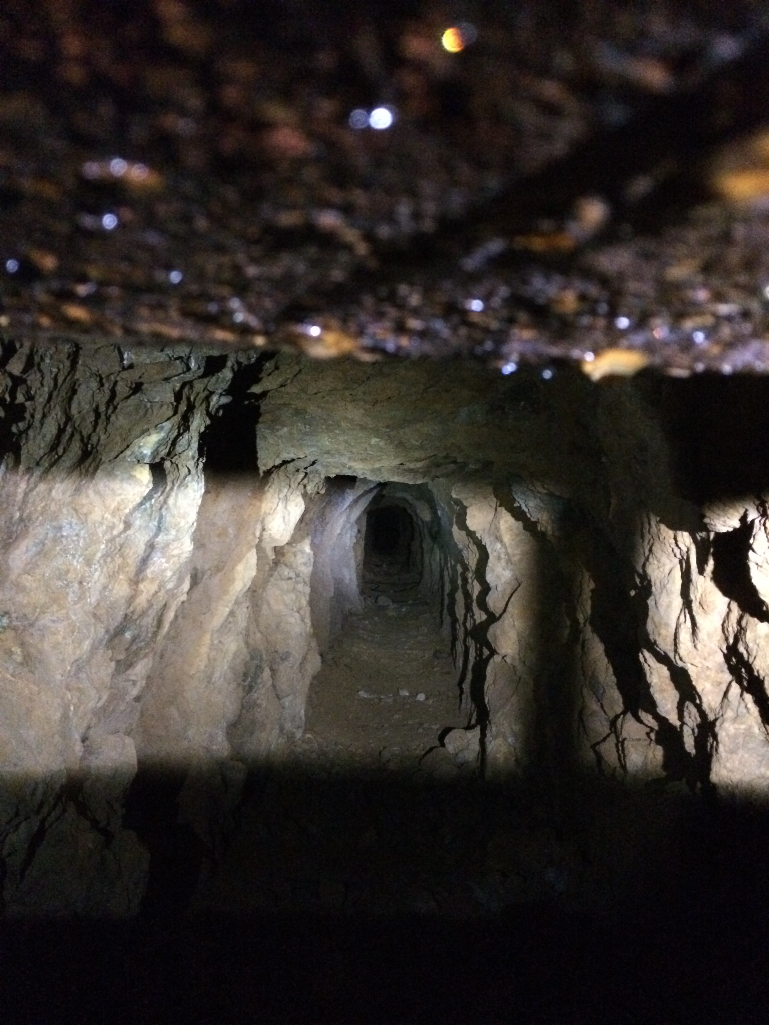
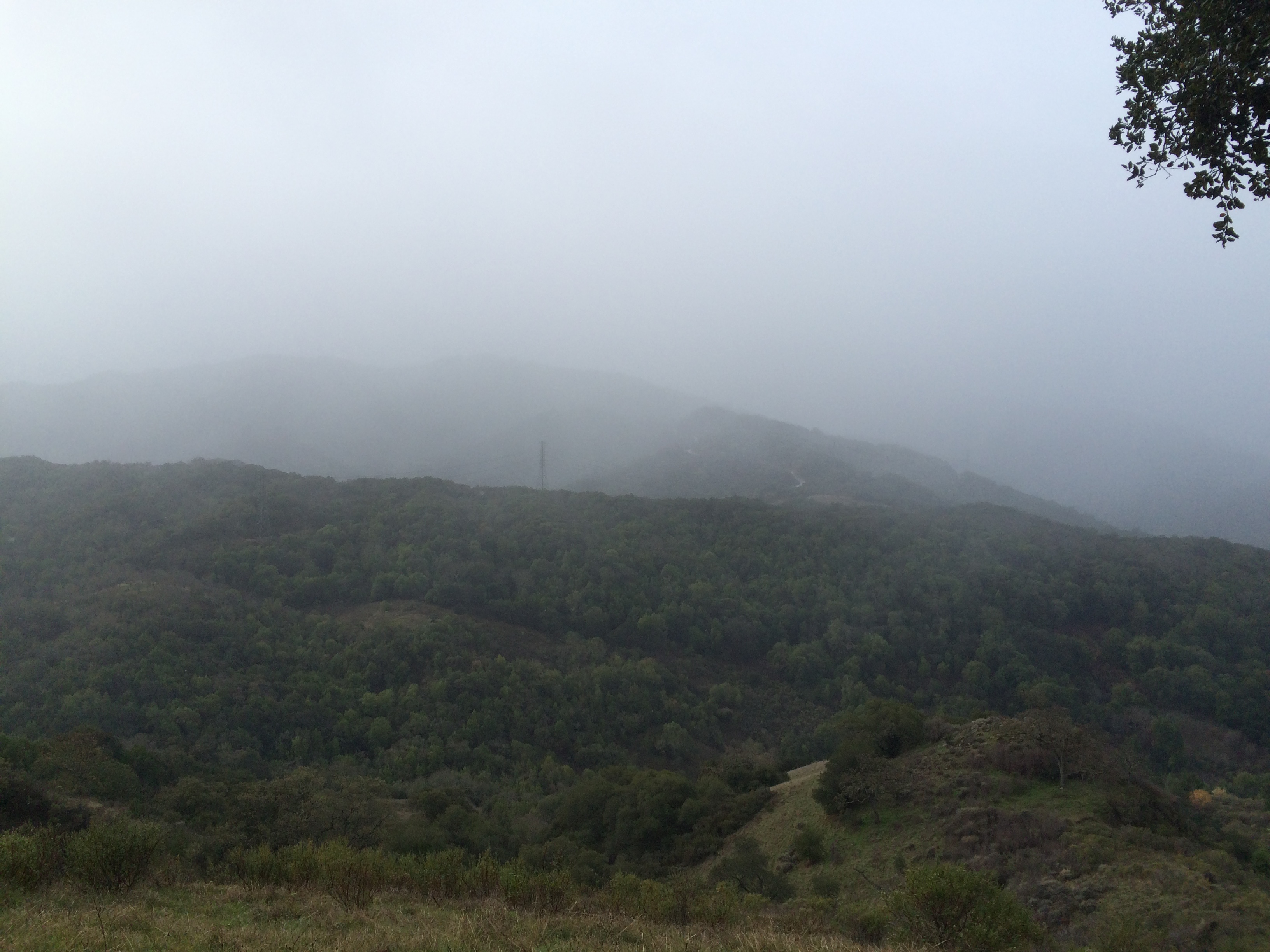
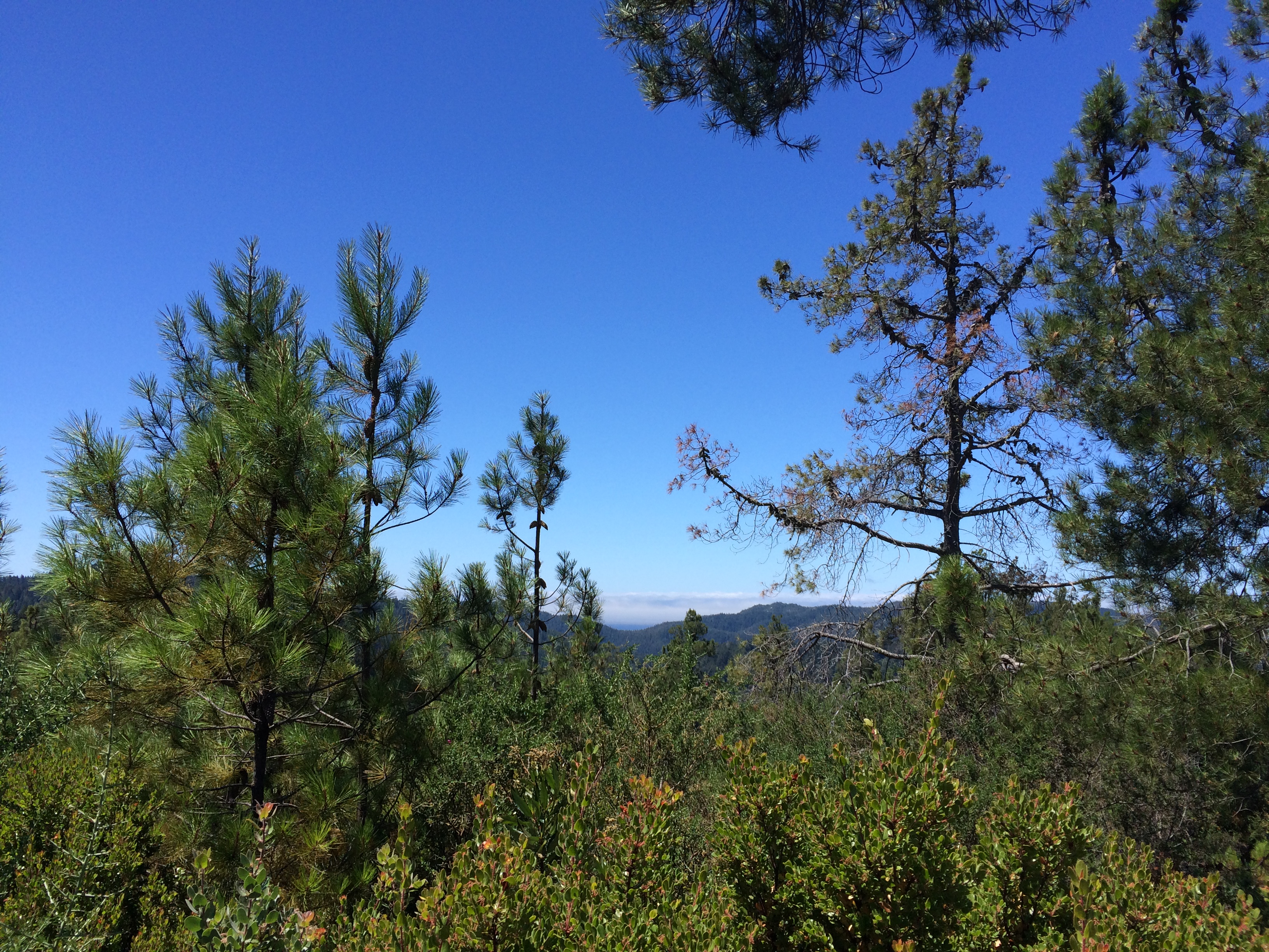
Big Basin Redwoods State Park: Sandstone Ridge

Wonderful……… and atĀ Ocean View Summit, you can just about see the water through the gap:

Big Basin Redwoods State Park: Ocean View Summit

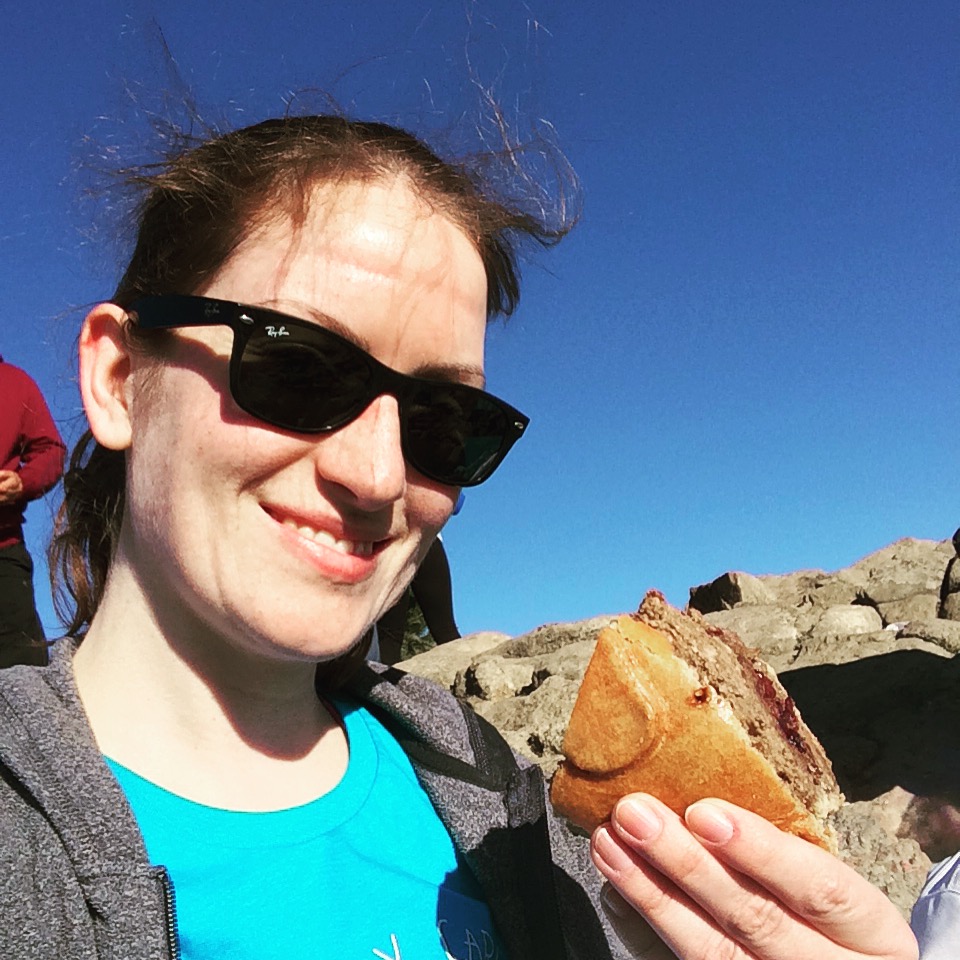
One final picture of an orangey grin selfie, taken while having a snack on a nice sandstone plateau at the top:

Big Basin Redwoods State Park: Orange Grin

One happy hiker!

Sanborn County Park. AKA that time we almost got lost in the woods.

We tried another new park to hike in this week!


This time we visited Sanborn County Park near Saratoga, it was kind of hilly and shaded by trees, and the weather was nice and sunny outside.

2016.02.08 Endomondo Data

You can download the park map here.

Our route took us from the Peterson Grove parking lot, through the nature trail to the San Andreas Trail. The San Andreas Trail splits into two, both of which are part of the San Andreas Trail, which rejoin again *sigh*. Zero signage.

Keep following the San Andreas Trail until you reach the junction with the Sanborn Trail, go left and follow this for 1.2 miles until you reach the Peterson Trail Junction. Go right, to stay on the Sanborn Trail following it back to the parking lot past the group campsites.

Sanborn County Park

The trails are unfortunately…. pretty poorly signposted, and multiple times the trail split in two with zero signs, to then rejoin into one again…… We didn’t actually get lost though, which may be more due to luck than anything else.

#skillz

I don’t think it was our favourite!

Waterfalls at Uvas Canyon

It was chilly this morning!

We decided to try out a new park that we hadn’t been to before, and browsed the Bay Area Hiker website for inspiration. We decided upon going to Uvas Canyon County Park, and based our hike on the one described here.

The described hike is a loop of 3.2 miles, but we decided to add a little extra to take in another waterfall, and a nice view across to the Diablo range in the east bay from Manzanita Point:

View from Manzanita Point

Parking in the main lot, take the road past the restrooms (featuring running water and SOAP!!!!!) up to the start of the waterfall loop trail. Take the left fork – Alec Canyon Trail, follow the steep trail up to the junction with Contour trail (0.5 miles), instead of going right, for an extra workout and view keep on Alec Canyon Trail up to the junction with the Triple Falls Trail (0.5 miles), taking in Manzanita Point on the way. The walk up to Triple Falls from this junction is 0.2 miles each way, or you can continue on Alec Canyon Trail 0.3 miles towards the Old Logging Camp. Or both šŸ˜‰

Triple Falls
Triple Falls

We then returned to the junction with the Contour Trail, and followed this to the Basin Falls Trail (1.6 miles), past the Upper Falls and the site of the old Hot House, where all that remains is a sign and some twisty rusted pipes:

Old Hot House Pipes

Upper Falls
Upper Falls

Basin Falls is 0.1 miles each way from this junction.

Continue across the bridge (0.1 miles) towards the junction with Knobcone Trail (a steep there-and-back-again trail of 0.4 miles to Knobcone Point) and then continue onto the Waterfall Loop Road. There is another short 0.1 mile trail just off here to Black Rock Falls.

Black Rock Falls
Black Rock Falls

From here continue following the Waterfall Loop Road down to the parking lot.

2016.02.01 Endomondo Data

It was a really lovely hike, nice and shaded, so still would be great on a sunny warm day.

The Santa Clara County Park website for this park includes both a trail map, and a nature trail guide for the (mostly) wheelchair accessible Waterfall Loop.

Deceptively hilly hike at Calero County Park

This afternoon we took what we thought would be a less intense pleasant stroll at Calero County Park, after our long hike at Big Basin at the weekend.

2016.01.11 Endomondo Data

It wasn’t.

It’s not entirely evident by the data, but the trail ends up as a very up and down, up and down, then up and up and up. It is deceptive, because the inclines are hidden behind corners or over ridges, and you just suddenly realize you have to go up some more!

You can download the park map here.

We were going to follow the hike as described on BAhiker here, but cut it a bit shorter as it was quite sunny and warm, so on such exposed trails we got a bit toasty, and also because we were feeling tired….. I never claimed that I didn’t get lazy!

Parking by the main entrance, we took the Access Trail > right on Los Cerritos Trail > right on Los Cerritos Trail > left on Peña Trail > left on Peña Trail > right on Los Cerritos Trail > left on Access Trail

Calero Reservoir

The reservoir at first glance didn’t look too bad, but then as we looked closer, the water should up to that upper line! It has just been empty/low for so long that the plants and grasses have taken over!

Just a short hike due to not having a lot of time, but quite pleasant even if it was deceptively hilly!

p.s. I have a fitbit, as do a few of my friends, and today one of them challenged me to a goal day – where you need to meet your step goal (mine is set to 10,000). I met mine at 197%! #nailedit

Winter Waterfalls at Big Basin Redwoods State Park

These past few weeks in the Bay area we have been having fairly heavy rain.

Yes! Rain!

For the previous two years we have lived here there was barely any, and so to take full advantage of the benefits of such precipitation, we took a long hike at Big Basin Redwoods State Park.

IMG_2997

Among other inducements, such as the beautiful Redwoods, the park features winter waterfalls.

Berry Creek Falls
Berry Creek Falls

You can download the full brochure here.

This was a hike to see Berry Creek Falls, Golden Falls, Cascades, and SIlver Falls, but taken in the opposite direction to that given on the BBRSP website.

2016.01.09 Endomondo Data

Use Skyline to the Sea Trail from the parking lot > left on Dool Trail > left on Sunset Trail > stay on Sunset Trail > go right to stay on Sunset Trail > left on Berry Creek Falls Trail > left on Skyline to the Sea Trail > stay on Skyline to the Sea Trail > follow Skyline to the Sea Trail back to park headquarters.

Although the hike (in the opposite direction as posted on the website) is described as strenuous, the main challenge is probably due to the length, rather than any steep grade.

Cascades
Cascades

There are some more challenging aspects – narrow trails, slippery rocks by the falls…. Oh and a lot of fallen trees.

Silver Falls
Silver Falls

But overall it wasn’t too tough at all, and the views of the falls and trees more than make up for it.

Golden Falls
Golden Falls

Today was also International Homemade Hobnob Day. Yep. It’s a thing. So we took some to the park with us….

Hobnobs on the trail.

Hobnobs all round!

#hikingmondays

For the next 6 weeks or so I have Mondays off, which is of course quite splendid.

What to do with this time? Grab a friend and get out hiking! As this friend is a fellow Brit, I couldn’t resist taking her to English Camp.

This was just a little short hike at Almaden Quicksilver County Park.

Currently there is a trail closure of Randol Trail, which makes planning a route a little more tricky – it either ends up just as a short one, or a bit longer than anticipated!

2015.01.04 Endomondo Data

You can find the full trail map here.

Starting at the Mockingbird Hill Lane Entrance, take the New Almaden Trail > left on Hacienda Trail > right on Capehorn Pass Trail > straight on Mine Hill Trail > straight on Mine Hill Trail > left on Castillero Trail > English Camp > left, back to Mine Hill Trail > continue on Mine Hill Trail back to Capehorn Pass Trail > right on Hacienda Trail > left on Virl O. Norton Trail > Mockingbird Hill Lane Entrance.

We saw one on these tiny little lizard things that I see quite often there:

Little lizard

We hope to go a little further next week!

A Short Steep Hike to the top of Mission Peak

Happy New Year!

I took advantage of a bonus day off to hike to the top of Mission Peak. We had previously done a long hike from Ed R. Levin County Park to the top of Monument Peak, but this a shorter – but very steep! – hike to the top of Mission Peak. This hike is described in it’s entirety on the Bay Area Hiker website here.

2015.12.31 Endomondo Data

Yup, just over 2000ft elevation gain over 3 miles, then back down again.Ā You can find a trail map here.

The view is pretty wonderful.

Mission Peak Panorama

…and we got to see the Christmas tree:

#xmasonthepeak

We took some Christmas dinner leftovers with us – have pie, will hike.

Pie on Mission Peak

The weather was pretty great for it, nice and cool, but sunny and clear. The main trail was in good condition, but Horse Heaven was a little muddy….

Muddy Horse Heaven

…and we manage to escape being maimed by the cows.

Cows @ Horse Heaven

Very important.

Almaden Quicksilver County Park, with added Mine action.

Classes finished last week until the start of the spring semester, so I now have Mondays off!

Hurrah!

I celebrated by heading out for a hike with the Midweek Hikers Meetup group, for a hike posted as 7.7 miles and 1000ft elevation…..

Lies.

2015.12.21 Endomondo Data

Although, this was not entirely intentional. Seasonal trail closures are in effect in Almaden due to the wet and muddy conditions, and so the original route via Randol trail had to be changed.

Starting at the Mockingbird Hill Lane Entrance, we took Virl O. Norton Trail > Hacienda Trail > Capehorn Pass Trail > Mine Hill Trail > Mine Hill Trail > Mine Hill Trail > Mine Hill Trail > Mine Hill Trail > there and back again on the San Cristobal Mine Trail to have a look at the San Cristobal Mine shaft tunnel

San Cristobal Mine Tunnel

You can walk a short way into the tunnel, then it is blocked off for safety, but you can see a little way inside:

San Cristobal Mine Tunnel

We then continued back on Mine Hill Trail > Mine Hill Trail > Prospect #3 Trail > Prospect #3 Trail > New Almaden Trail > there and back again on the Buena Vista Trail to the Buena Vista Shaft > New Almaden Trail > New Almaden Trail back to Mockingbird Hill Lane.

Our usual spot for a view across to Mount Umunhum was somewhat obscured by the rainy weather!

Rainy Almaden Quicksilver County Park

Actually a good day for a hike! There was intermittent drizzle, but not fully raining.

Black Friday at Henry Cowell Redwoods State Park

This year, much like every year, we avoided the black friday crowds – I just don’t get it – and joined REI by deciding to #optoutside. We took the opportunity to visit a park that we hadn’t been to before, Henry Cowell Redwoods State Park in Felton, CA.

Henry Cowell Redwoods State Park

It really isn’t far away, but we just hadn’t visited it before now, and it was a wonderful day out among the redwoods. (It also features a steam railway….. we are definitely going to try that out sometime!)

2015.11.28 Endomondo Data

Route: Pipeline Road > right on River Trail > left on Eagle Creek Trail > left on Pine Trail > right on Graham Hill Trail > right on Pine Trail > straight on Pine Trail > Observation Deck > right on to Ridge Fire Road > right on Pipeline Road. You can find the trail map here.

Henry Cowell Redwoods State Park: Lunch at the Observation Deck

We packed some Thanksgiving leftovers (nut roast pie), and stopped for half an hour for lunch on top of the observation deck. From this vantage point, you can see the sea over the tops of the trees, and on a clear day, like we had, all the way to Monterey and beyond to Big Sur:

Henry Cowell Redwoods State Park: to the Sea

The weather had cooled off, so was ideal hiking weather, even in the middle of the day, complete with clear blue skies as far as the eye could see.

Wonderful.

Henry Cowell Redwoods State Park

..and when a fallen tree blocks your path, time to find a new path around these obstacles, such it is in hiking as well as life…

Henry Cowell Redwoods State Park: Fallen Tree

I am thankful for good health, friends and family. I am not thankful for Black Friday sales. They can go take a hike.

Almaden Quicksilver County Park: Mockingbird Hill Lane Entrance

This morning we went on a nice short hike, after a few weekends of not much excitement. The last couple of weekends were all about trying to reduce some of the clutter in our apartment, playing games and eating brunch! My outdoor activity has been limited to jogs along the cycle trail, and cycling up to and around the bay.

Anyway… this morning:

2015.08.29 Endomondo Data

About 3.7 miles of slightly hilly hiking, we started off fairly early to avoid the heat of the daytime. Endomondo claims that the weather was dreary (!), but I can assure you that while the day started off a little cloudy, it was a regular old sunny blue sky day later on!

Almaden Quicksilver County Park

The route we took started from the Mockingbird Hill Lane entrance, which is a great one, plentiful in parking, and having restrooms with running water! We followed Hacienda Trail – straight over to continue on Hacienda Trail – right on Capehorn Pass Trail – right on Randol Trail – continue on Randol Trail – right to continue on Randol Trail (past the Buena Vista Shaft) – right on to Buena Vista Trail – right on to New Almaden Trail – then straight over to continue on New Almaden Trail to return to the Mockingbird Hill Lane Entrance. (see below)

Trail Map

You can download the full map of the park here.

This route takes you past the remains of the Buena Vista Shaft:

Almaden Quicksilver County Park: Buena Vista Shaft

Originally, when it was an operational mine shaft, a big red building was on top of these foundations, which was visible all the way down into San Jose. These days of course all that remains are the stone foundations and a load of metal, and the shaft itself is blocked off with a metal grid:

Almaden Quicksilver County Park: Buena Vista Shaft

Now, the only dangers are from rocks and the metal screws embedded in the foundations, and the occasional bit of Poison Oak.