Tag Archives: Hacienda Trail

Almaden Quicksilver County Park, with added Mine action.

Classes finished last week until the start of the spring semester, so I now have Mondays off!

Hurrah!

I celebrated by heading out for a hike with the Midweek Hikers Meetup group, for a hike posted as 7.7 miles and 1000ft elevation…..

Lies.

2015.12.21 Endomondo Data

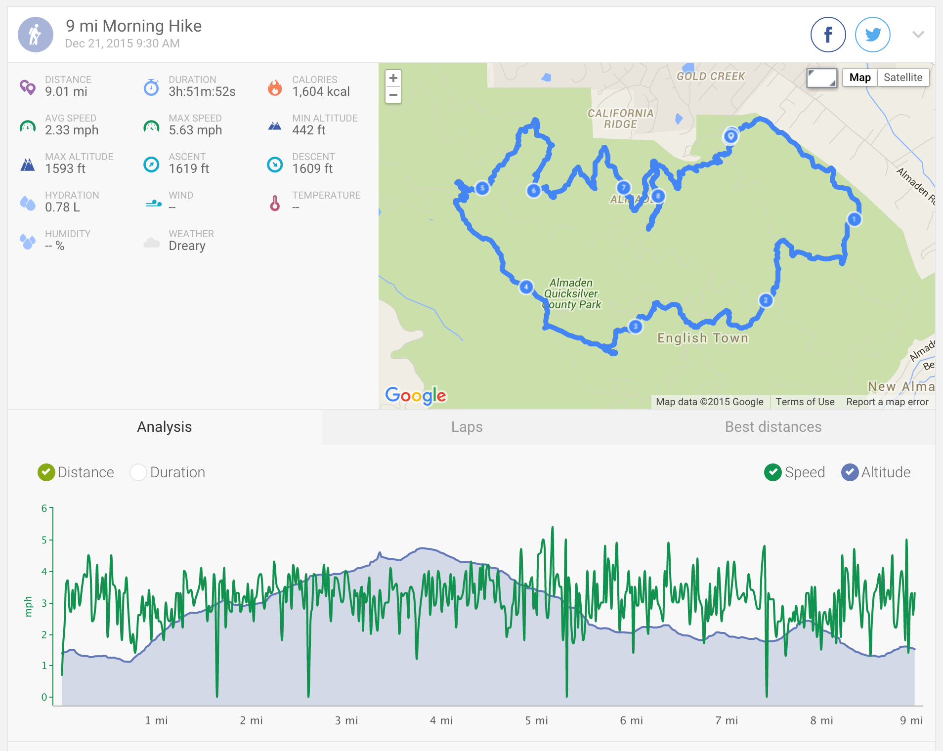
Although, this was not entirely intentional. Seasonal trail closures are in effect in Almaden due to the wet and muddy conditions, and so the original route via Randol trail had to be changed.

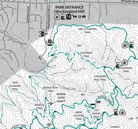
Starting at the Mockingbird Hill Lane Entrance, we took Virl O. Norton Trail > Hacienda Trail > Capehorn Pass Trail > Mine Hill Trail > Mine Hill Trail > Mine Hill Trail > Mine Hill Trail > Mine Hill Trail > there and back again on the San Cristobal Mine Trail to have a look at the San Cristobal Mine shaft tunnel

San Cristobal Mine Tunnel

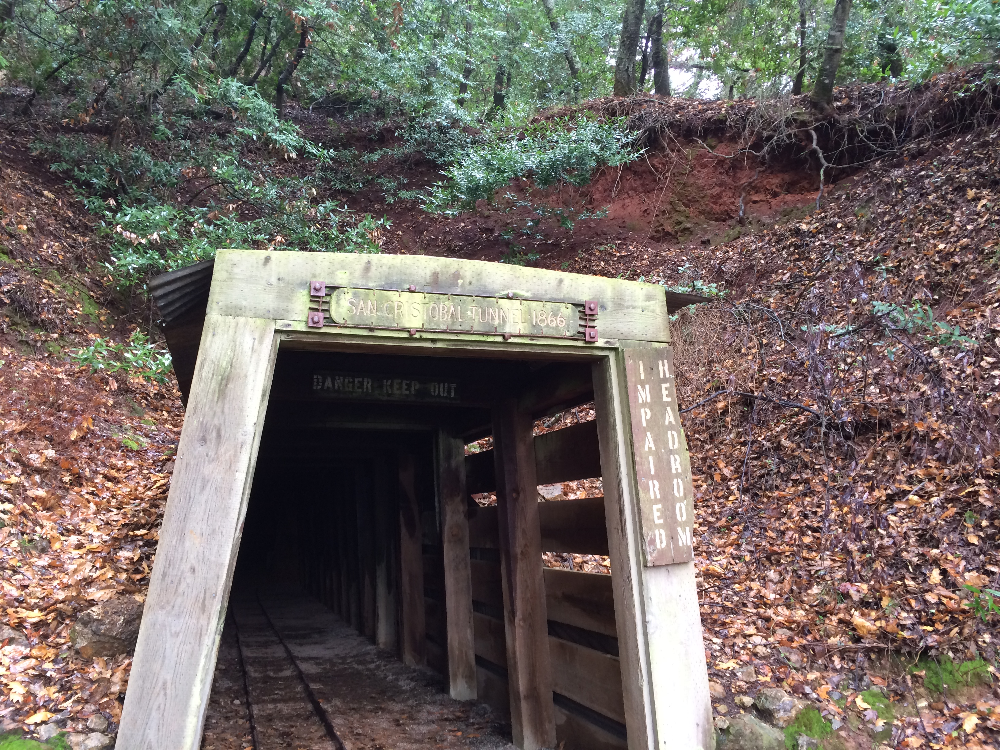
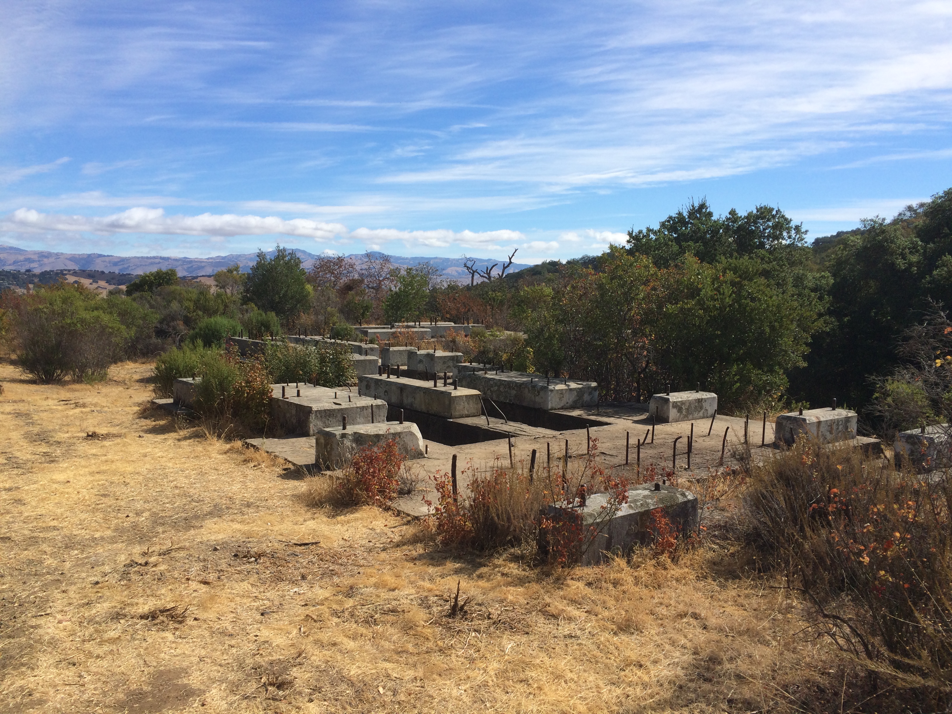
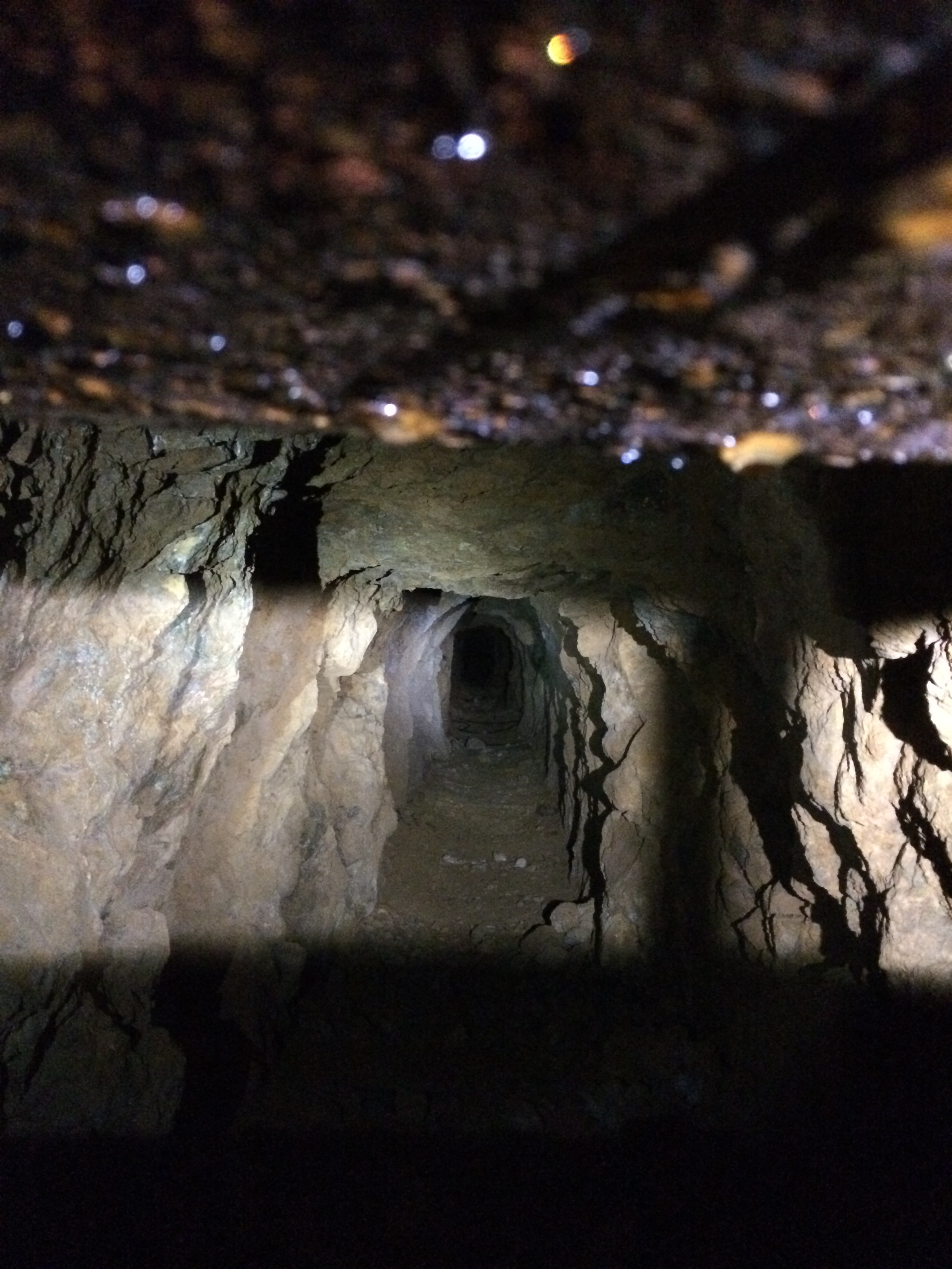
You can walk a short way into the tunnel, then it is blocked off for safety, but you can see a little way inside:

San Cristobal Mine Tunnel

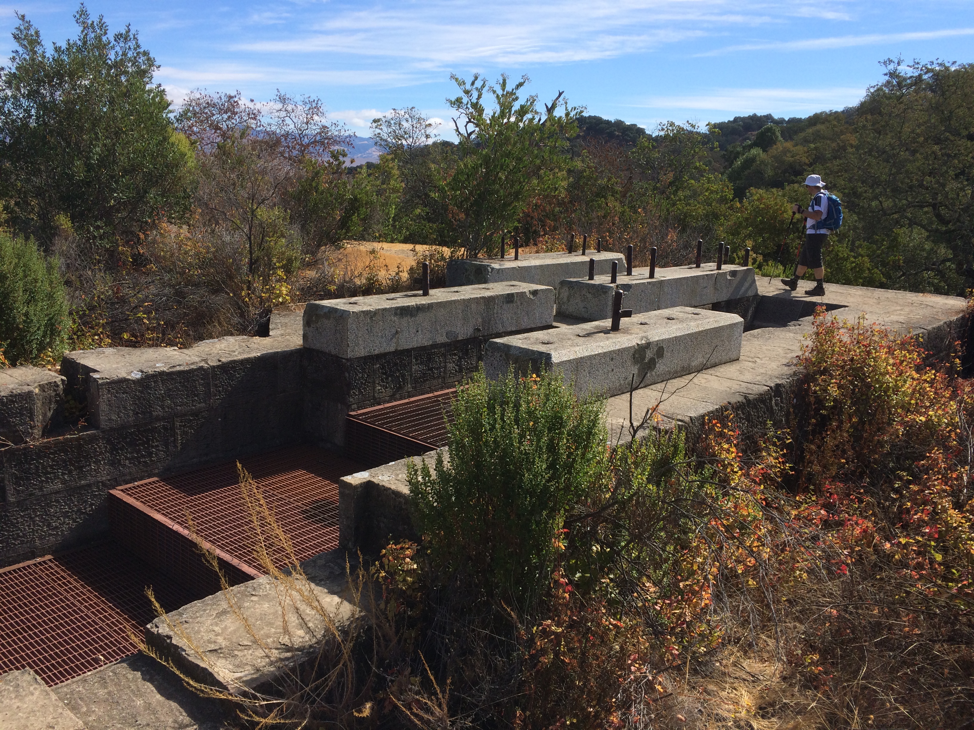
We then continued back on Mine Hill Trail > Mine Hill Trail > Prospect #3 Trail > Prospect #3 Trail > New Almaden Trail > there and back again on the Buena Vista Trail to the Buena Vista Shaft > New Almaden Trail > New Almaden Trail back to Mockingbird Hill Lane.

Our usual spot for a view across to Mount Umunhum was somewhat obscured by the rainy weather!

Rainy Almaden Quicksilver County Park

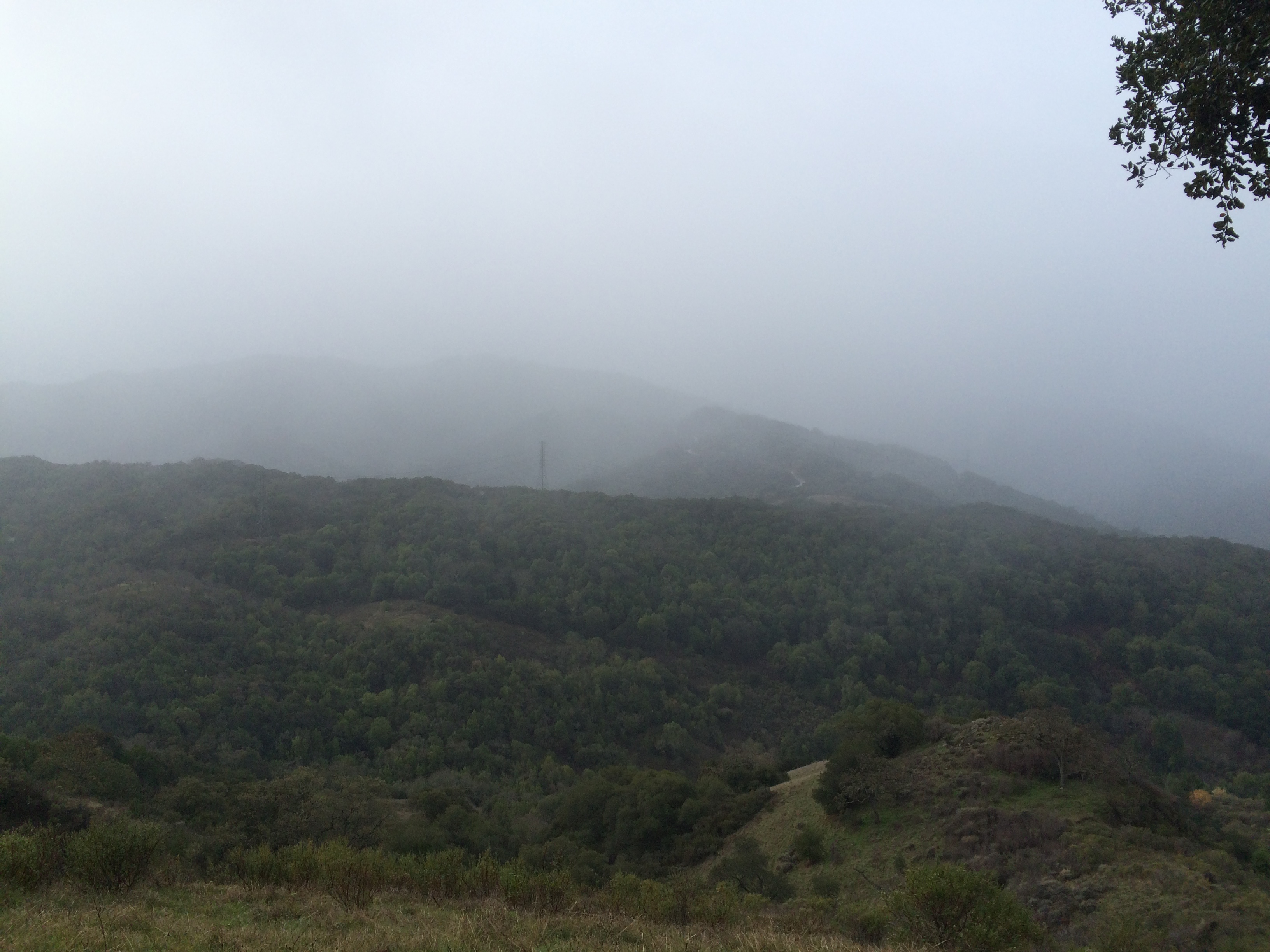
Actually a good day for a hike! There was intermittent drizzle, but not fully raining.

Almaden Quicksilver County Park: Mockingbird Hill Lane Entrance

This morning we went on a nice short hike, after a few weekends of not much excitement. The last couple of weekends were all about trying to reduce some of the clutter in our apartment, playing games and eating brunch! My outdoor activity has been limited to jogs along the cycle trail, and cycling up to and around the bay.

Anyway… this morning:

2015.08.29 Endomondo Data

About 3.7 miles of slightly hilly hiking, we started off fairly early to avoid the heat of the daytime. Endomondo claims that the weather was dreary (!), but I can assure you that while the day started off a little cloudy, it was a regular old sunny blue sky day later on!

Almaden Quicksilver County Park

The route we took started from the Mockingbird Hill Lane entrance, which is a great one, plentiful in parking, and having restrooms with running water! We followed Hacienda Trail – straight over to continue on Hacienda Trail – right on Capehorn Pass Trail – right on Randol Trail – continue on Randol Trail – right to continue on Randol Trail (past the Buena Vista Shaft) – right on to Buena Vista Trail – right on to New Almaden Trail – then straight over to continue on New Almaden Trail to return to the Mockingbird Hill Lane Entrance. (see below)

Trail Map

You can download the full map of the park here.

This route takes you past the remains of the Buena Vista Shaft:

Almaden Quicksilver County Park: Buena Vista Shaft

Originally, when it was an operational mine shaft, a big red building was on top of these foundations, which was visible all the way down into San Jose. These days of course all that remains are the stone foundations and a load of metal, and the shaft itself is blocked off with a metal grid:

Almaden Quicksilver County Park: Buena Vista Shaft

Now, the only dangers are from rocks and the metal screws embedded in the foundations, and the occasional bit of Poison Oak.