Category Archives: Mountain Biking

El Corte de Madera Creek Open Space Preserve

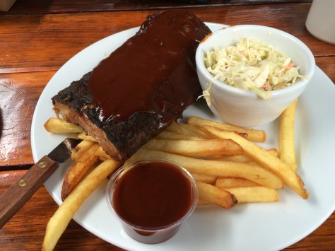
So with brother coming to stay, I felt we should get out and explore at least one of the famous mountain bike routes of the Bay Area. If you’re wondering why the image above, the location was chosen as it was near to Alice’s, so that he could sample their amazing baby back ribs of course.

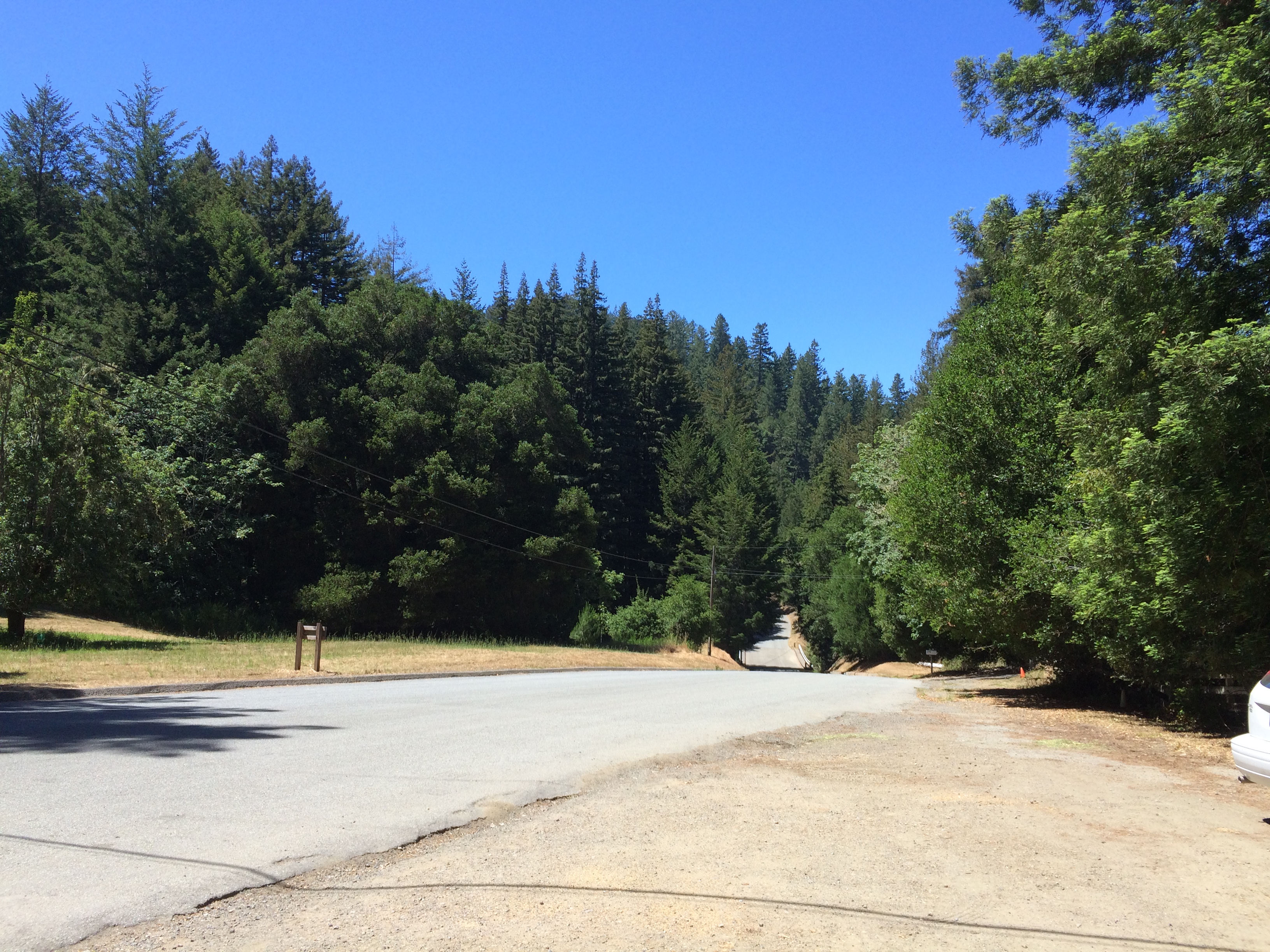
A quick google revealed what we thought would be a reasonably challenging, yet do-able, 10 mile ride starting from Skeggs Point:

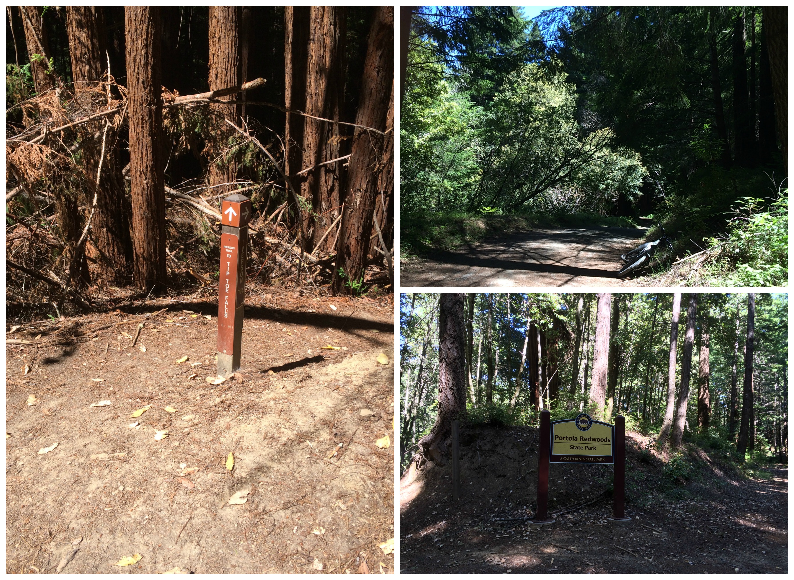
The ride plan was taken from this site, which has a lot of detailed information including gps track data, which I’d uploaded to my Garmin, as the advice was it’s pretty easy to get lost at this park. The park website is here.

After a reasonably flat start along Tifoni Trail then Fir Trail, the downhill along Resolution Trail started – which was single track and quite technical in places. At this point it became quickly apparent that the ride was going to be a little harder than we had planned for, both in technical and aerobic abilities required. All this downhill meant only one thing – mostly uphill on the way back!

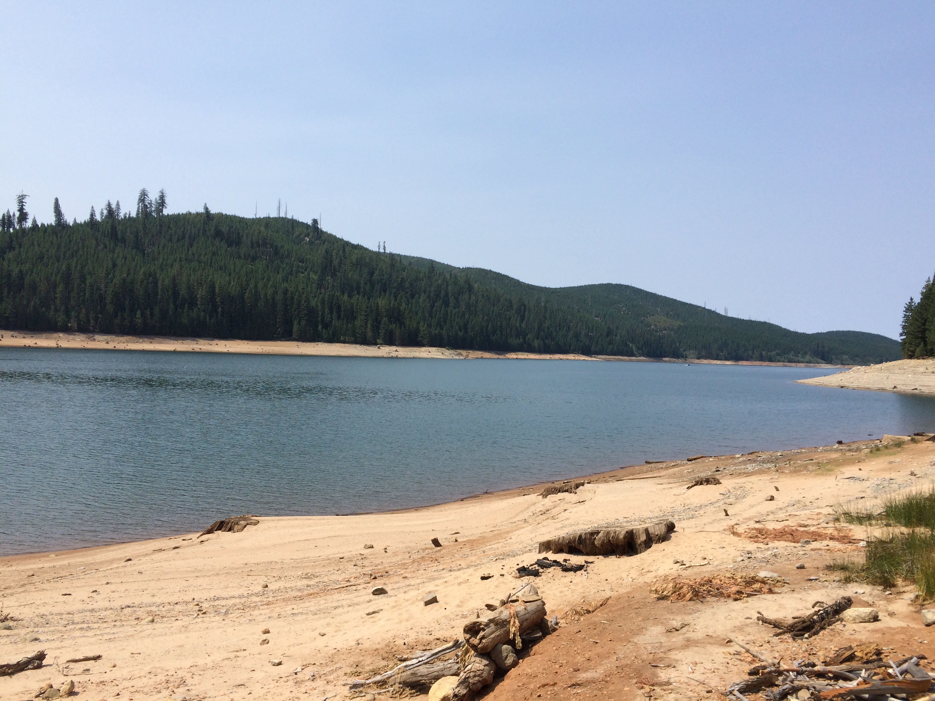
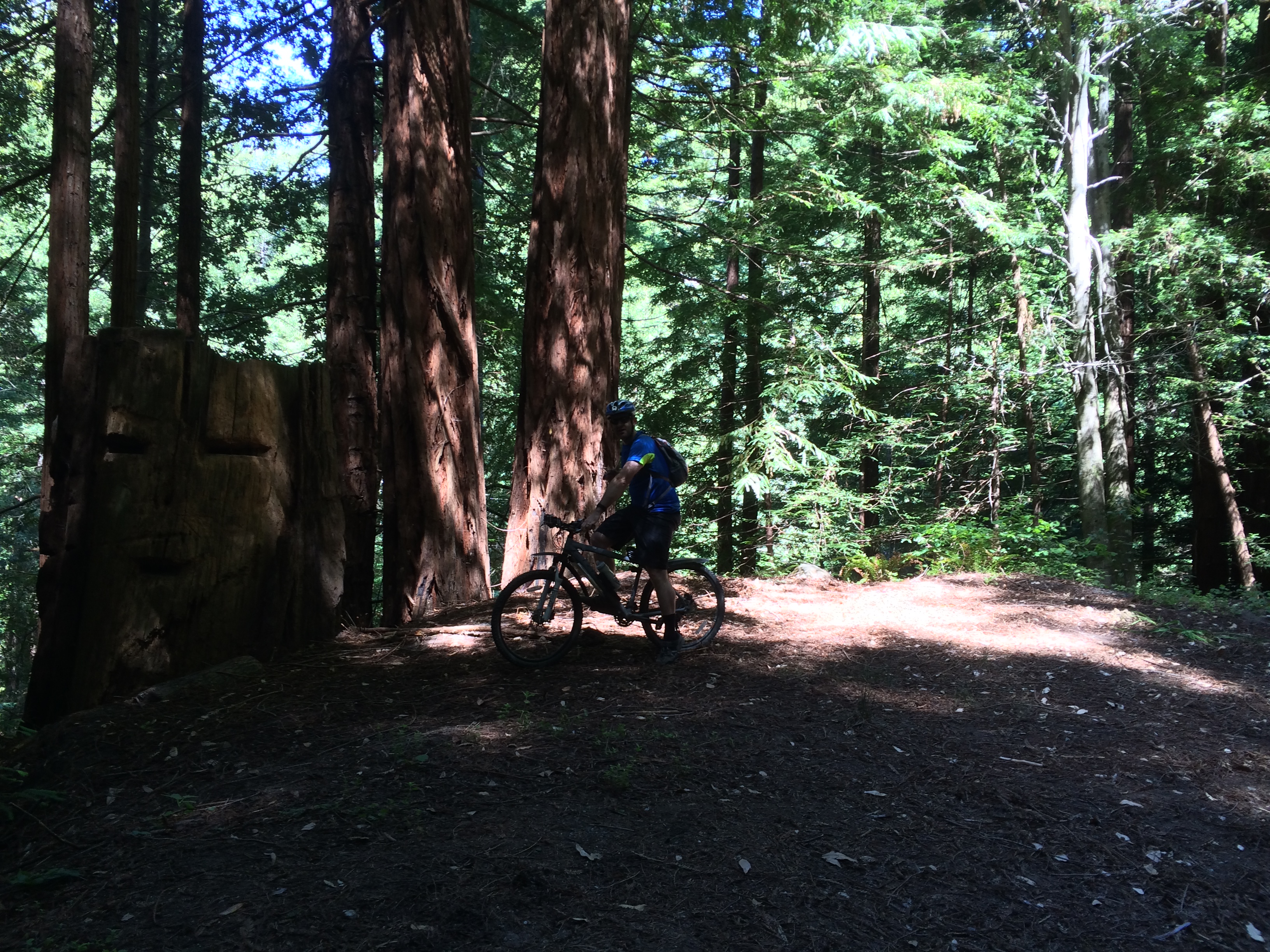
Still, after only about 2.5 miles, we turned left onto El Corte de Madera Creek Trail and descended further toward the creek. A little less than a mile later, and with the realization that much more downhill was to come on the planned 10 mile route, we decided to modify our route to take an alternative trail back to the top, without the additional 500 ft descent/ascent.

At around 1 hour in, we turned around and headed back along Madera Creek Trail back to the Resolution Trail junction. Here we continued on the Creek trail for one epic climb back to the Parking Lot.

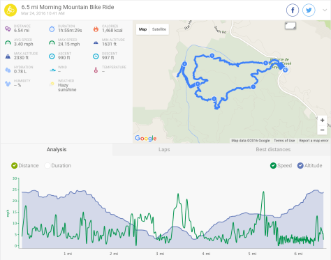
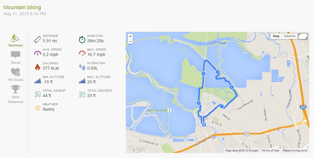
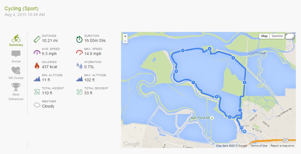
This was what we’d accomplished…

Screen Shot 2016-03-27 at 9.19.14 AM

This was of course, justification enough for some of these:

IMG_3062

Maybe next time, I will try to conquer a longer route. Watch this space….

Mallard Slough Trail

Last night after Andrew finished work, we took a quick cycle out on the Bay.

This cycle picks up from the same location as the Alviso Slough Trail, except instead of heading out on that trail, we cycled to the Mallard Slough Trail, a smaller trail to the east pictured in orange on the below map:

Alviso and Mallard Slough Trail

From the end of the Lower Guadalupe River Trail, turn right and follow Gold St-right on Catherine St-left/straight onto State St-right on Spreckles Ave-left on Grand Blvd and left again to stay on Grand Blvd and follow it across the train tracks and round to the car park and US Fish and Wildlife Service buildings by the bay.

Railroad Crossing

The Mallard Slough Trail is 3.3 miles in total, or you can cut across to the Alviso Slough Trail via a bridge over the railroad tracks, and take that trail back to the Alviso Marina County Park parking lot.

Mallard Slough Trail

It is a nice, well maintained trail, with vista points and information along the way.

2015.08.11 Endomondo Data

We decided to follow the Mallard Slough Trail, then cut across to the Alviso Slough Trail to go back to the Alviso Marina County Park parking lot, and then followed Hope St-left on Catherine St-right on El Dorado St-left on Moffat St-right on Gold St (the alternative to taking the Public Shore gravel path back across the tracks), and then we were back to the end of the Lower Guadalupe River Trail.

Mallard Slough Trail

Union Valley Bike Trail

Union Valley Reservoir

This weekend Andrew and I took a trip up to the Eldorado National Forest, and camped at Wench Creek Campground on the east shore of the Union Valley Reservoir. There was a big group of us heading up there for my friend’s boyfriend’s birthday, so we reserved Group Site 2, and it was pretty excellent.

Group site 2 includes space for 50 people, flushing toilets, a big camp fire ring with seating all around it, 3 fixed BBQ grills, plenty of tables…… generally is really well set up for a large get together with friends…..

Except no showers. It would be absolutely perfect with showers 😉

Another excellent thing about the campground is that the Union Valley Bike Trail runs along the bottom of the campground, so you can easily hop onto it and indulge in a little there-and-back-again cycle along the shore of the reservoir, and through the forest.

Union Valley Bike Trail

“If I fall… would you guys catch me?”

On Saturday morning we cycled from our group campground to the end of the trail at the main Wench Creek Campground, then followed the trail down to Jones Fork Campground, and back to our site.

2015.08.08 Endomondo Data

You can download the full map of the trail here.

Union Valley Bike Trail

The trail crosses a few creeks that feed into the reservoir, and should fill it with water…. obviously at the moment, much like the rest of California… it is somewhat dry:

Union Valley Reservoir
Union Valley Reservoir Union Valley Reservoir


All those sandy/muddy beaches should be covered in water. Alas, they are not.

It is a really pretty cycle, with some little hills, paved the entire way. It is mostly shaded by the forest, so stays pretty cool too.


Alviso Slough Trail

Yesterday morning I went out on my bicycle for a quick ride around the old salt ponds at Alviso:

Alviso Slough Trail

(You can download the full map here)

These ponds form part of the Don Edwards San Francisco Bay Wildlife Refuge, that extends around most of the lower part of the bay.

The start of this ride is the northernmost end of the Lower Guadalupe River Trail, where it meets Gold Street. If you look across the road at this point, a gravel track leads across the railroad tracks to the public shore, a gravel trail that will take you to the Alviso Marina County Park parking lot.

Lower Guadalupe River Trail


(Note: you could also park at the Alviso Marina County Park parking lot, and start the cycle from there)

Be careful when crossing the tracks that you check for oncoming trains, but you can’t miss them…. they are kinda loud! It is an Amtrak line, so has limited train traffic.

Once at the Marina cycle through the parking lot towards the entrance, then out towards the trail.

The Alviso Slough Trail is 8.6 miles long, the added bit from the end of the Lower Guadalupe River Trail makes this ride 10.2 miles… or at least according to Endomondo:

15.08.04 Endomondo Data


I cycle to the end of the trail first, which adds almost another 7 miles total. It was slightly overcast yesterday, with a bit of a breeze, which can make the cycle a little more challenging, but overall it is a flat, gentle, and scenic cycle. It is also very exposed, so I wouldn’t recommend it on a hot day, but with a breeze it keeps you cool, and also keeps the bay stink from being too overpowering!

Alviso Slough Trail

On a clear day, you can see the hills and mountains all around the bay, and their reflection in the water.Alviso Slough Trail


Also, on a clear day if you look north, up the train lines, you can see some of the remains of Drawbridge, an old abandoned railroad station and ghost town, just hanging out there by the train tracks, and slowly sinking into the mud.

Alviso Slough Trail

Old Haul Road Trail from Wurr Road to Portola Redwoods State Park

For Andrew’s birthday this year, I bought him a book on mountain biking in the Bay Area, along with the promise that I would come out for a ride at least once.

(I generally have a fear of proper mountain biking, I don’t feel like I have the skill or balance or coordination on two wheels that I have on my two feet!)

This ride came from that book, and seemed like a good starter ride for those none too confident in their bike riding skills (like myself).

The ride took us along the Old Haul Road trail from Wurr Road right into Portola Redwoods State Park.

The parking lot on Wurr Road

The view from the parking lot on Wurr Road

You can get the park brochure here. You follow Old Haul Road right to the SP boundary, where a signpost directs you into the park.

Portola Redwoods State Park

The book quotes the ride as being 12 miles, but as you can see below, Endomondo disagrees a little.

15.06.21 Endomondo Data

As you ride into the park down a steep bit of trail, you come across the remains of the Iverson Cabin. It had stood from the 1860s until Loma Prieta finished it off in 1989.

Iveson Cabin

The sign reads:

“At this site stood the cabin of Christian Iverson, the first european settler of record. Built in the 1860’s, the cabin was constructed of hand split redwood and had two rooms. It stood until the Loma Prieta earthquake of 1989.

Iverson made his living in this area splitting redwood shakes, working for local farmers, doing road work, and other odd jobs. Iverson had an eventful past working as a pony express rider and as a stage coach shotgun guard.

The famous of these events was a shoot out with Captain Harry Love in the streets of Santa Clara. Captain Love was the former head of the California Rangers, who were responsible for the capture of the famous outlaw Joaquin Murrietta. At the time of the shootout, Iverson was working as a bodyguard and foreman for Mrs Love, much to the displeasure of her husband. Harry Love attempted to ambush and kill Iverson, but in the ensuing gun fight Iverson received only minor wounds. However, in the exchange of gunfire Iverson shot Harry Love who died from his injuries. Mrs Love died later of gunshot wounds she received during the fight.”

Hmmmmm…. perhaps he wasn’t a particularly good bodyguard. But I do love it when there are random historical artifacts and structures along the way 🙂

There is a visitor center in the park, along with restrooms and water, but the restrooms we went to beside the visitor center are closed to conserve water, so just behind the visitor center, there are instead portable toilets.

Unpleasant.

I recommend you take some wipes or sanitizer for your hands!

The trail is pretty smooth as is a road used by park trucks, and previously used to haul logs out of the woods in bygone days. It is also nice and shaded, which keeps things nice and cool.

Tree face

Overall it was a nice intro for me….. but I am still scared of going down hills!

Happy Birthday Andrew!

Andrew + Trees

Note: you can also hike the exact same route, and there are some extra trails off the main trail that are closed to bikers, but open to hikers. Also, if any bikers fancy it, you can lock up your bikes at the visitor center and take a short hike to see some mighty big trees!